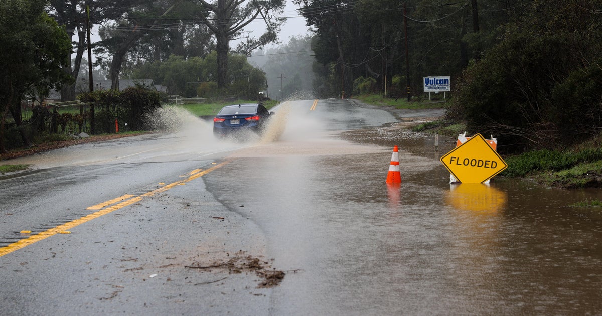
Another “atmospheric river” is expected to dump more rain and snow on parts of California this week — and it’s not the first time this type of weather phenomenon has brought dangerous flooding conditions to the state.
What is an atmospheric river and why are they repeatedly in the forecast for the West Coast?
What are atmospheric rivers?
Atmospheric rivers are long regions in the atmosphere that transport water. The water vapor they carry is roughly equivalent to the average flow of water at the mouth of the Mississippi River, according to the National Oceanic and Atmospheric Administration. So, when they make landfall and release all that water, they can cause extreme flooding.
They are an important part of the world’s water cycle, often contributing to water supplies, NOAA points out.
“They are extremely important to the water supply in the western United States and are part of the earth’s ocean water cycle,” The Weather Channel meteorologist Jacqui Jeras told CBS News. “The snowpack in the mountains in particular is important for drought relief and filling reservoirs. It’s like saving up money in the bank during these events to be spent in the spring when the snow melts and fills the reservoirs.”
John Locher / AP
How destructive are they?
In 2009, an atmospheric river that hit northwest Britain carried about 4,500 times the amount of water than the River Thames in London, causing extreme flooding in the area, according to a 2013 study by the University of Reading and the University of Iowa.
A 1998 study by MIT found an atmospheric river can have the same moisture flux as the Amazon River — carrying about 176,000 tons of water per second.
What are the atmospheric river categories?
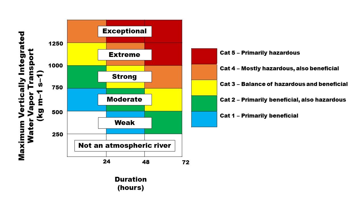
The United States Geological Survey says high-intensity atmospheric rivers can be as destructive as hurricanes. Similar to hurricanes, these storms have a rating system — but their ratings incorporate the idea that they can be beneficial, hazardous or both.
The ratings range from Category 1 to Category 5, with the higher numbers indicating an escalating level of hazard. USGS explains:
- Category 1 (weak): A Category 1 atmospheric river would be a milder and briefer weather event with primarily beneficial effects, like 24 hours of modest rainfall.
- Category 2 (moderate): A Category 2 atmospheric river is a moderate storm with mostly beneficial effects, but also somewhat hazardous.
- Category 3 (strong): A Category 3 atmospheric river is more powerful and longer lasting, with a balance of beneficial and hazardous impacts. For example, a storm in this category could bring 5-10 inches of rain over 36 hours, enough to help replenish reservoirs but also pushing some rivers close to flood stage.
- Category 4 (extreme): A Category 4 atmospheric river is mostly hazardous, though also with some beneficial aspects. A storm of this rating could dump enough heavy rain over several days to bring many rivers to flood stage.
- Category 5 (exceptional): A Category 5 atmospheric river is primarily hazardous. The USGS gives the example of an atmospheric river that lasted over 100 hours over the Central California coast during the 1996-97 New Year’s holiday period. The heavy rain and runoff caused over $100 billion in damage.
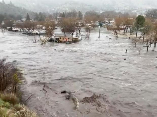
In addition to flooding, the heavy rain from atmospheric rivers can also cause landslides, and strong winds can knock over trees and power lines.
United States Geological Survey
Not all atmospheric rivers cause damage, and they can bring necessary rain or snow to enhance water supplies and build up much-needed snowpack in the mountains, according to NOAA.
How common are atmospheric rivers, and where do they happen?
There are typically between three to seven atmospheric rivers present in the world at any given time — and they’re not just on the West Coast of the U.S., according to The Weather Channel.
In 2015, an atmospheric river that was more than 5,000 miles long accompanied a massive Atlantic storm that caused widespread flooding in the U.K., Ireland and Norway.
A 2013 study by the University of Reading and the University of Iowa found the phenomenon may become more common in the U.K. and cause more severe winter flooding. Atmospheric rivers are expected to become increasingly frequent and more severe climate change, the researchers say.
In 2010, an atmospheric river fed into a storm taking aim at the U.S. Mid-Atlantic states, resulting in a “snowmageddon,” The Weather Channel reported.
And it says atmospheric rivers often make the rainy season in China, known as Mei-Yu season, even worse.
A well-known atmospheric river is the “Pineapple Express” — this is the system that brings moisture from Hawaii over to the West Coast of the mainland U.S.
Matt Volpert/gorafting.com/via REUTERS
In the Sierra Nevada, atmospheric rivers are 2.5 times more likely to result in destructive “rain-on-snow” events — when rain falls on snowpack and freezes — than other types of winter storms, according to a study by NASA.
“Atmospheric rivers can happen almost anywhere across the globe, but are most notable in the United States across the West,” Jeras said.
And while just 17% of storms on the West Coast are caused by atmospheric rivers, they contribute to 30% to 50% of California’s precipitation. They also contribute to 40% of Sierra snowpack, and more than 80% of the state’s major floods, the NASA study found.
Atmospheric rivers are predictable and can sometimes be forecast up to a week in advance, says The Weather Channel. Similar to using hurricane-hunter aircraft to track hurricanes, Scripps Institution of Oceanography can drop sensors into atmospheric rivers to collect data on them.
“It is not uncommon to have multiple ARs every winter. The rain and snow pack we’ve had so far in the West will not bust the drought, but it is a good start,” Jeras said, adding that while there can be devastating impacts from these storms, “we need the snow to keep coming in the mountains and to stay frozen until the spring to bring a more substantial impact.”


